Day trip — 65 km south of Marrakech
Imlil and theHigh Atlasday trip from Marrakech
Imlil sits 65 km south of Marrakech, a 1 h 30 drive, at 1,740 m of altitude. The village is the trailhead for Jbel Toubkal, the highest summit in North Africa.
The three valleys loop, Asni, Moulay Brahim and Imlil, extends the day over 120 km at the same transport price.
How does a day in Imlil unfold?
The day leaves Marrakech at 8:00 and returns at 17:30. It includes 1 h 30 of driving out, four hours of walking around Imlil and Armed, and a return through the three valleys loop.
- 08:00
Pickup at your accommodation
Your driver calls at your riad in the medina, your hotel in Guéliz or your villa in the Palmeraie, for the road up to Imlil.
0 km - 08:40
Tahannaout, gateway to the Asni valley
The road leaves the Haouz plain and climbs toward the first foothills of the High Atlas.
33 km - 09:00
Asni and its souk
Asni holds its weekly souk on Saturday. On other days the village mainly serves as a staging point before the climb to Imlil.
47 km - 09:20
Moulay Brahim, village above the gorge
The road runs past the pilgrimage village, perched above a gorge cut by the Rherhaya river.
55 km - 09:45
Arrival in Imlil
Imlil, at 1,740 m, marks the end of the paved road and the start of the trails toward Jbel Toubkal.
- 10:15
Walk to Armed
The trail climbs from 1,740 to 1,900 m over 3 km, to the highest village in the valley.
- 12:30
Berber lunch in Imlil
Tagine served on a terrace facing the valley, at a guesthouse in Imlil.
- 14:00
Return through the three valleys loop
The route descends through Asni then Moulay Brahim, closing a 120 km loop from Marrakech.
120 km - 17:30
Drop-off at your accommodation
Back at the pickup address.
Walkers heading up to the Toubkal refuge leave Imlil as early as 7:00, with the minibus return set for the following day.
What is there to see on the three valleys loop and in Imlil?
The three valleys loop links the Asni valley, the Moulay Brahim valley and the Imlil valley over 120 km. Imlil marks the high point of the visit, facing Jbel Toubkal, at 4,167 m.
The Asni valley
Asni is a foothill village 47 km from Marrakech that holds a weekly souk on Saturday, the busiest in the region after Marrakech itself.
The Asni valley opens the road access to the High Atlas from the Haouz plain, before the road climbs toward Moulay Brahim and then Imlil.
The Moulay Brahim valley
Moulay Brahim is a pilgrimage village built above a gorge cut by the Rherhaya river. A local mausoleum draws pilgrims year-round, with a peak in summer.
The gorge separates the Asni valley from the Imlil valley and gives its name to the second of the loop’s three valleys.
The Imlil valley and Jbel Toubkal
Imlil is the departure village for Jbel Toubkal, 4,167 m, the highest summit in North Africa. Reaching the summit takes two days of walking with a night at the refuge.
For a single-day trip, the walk stops at the village of Armed or near the waterfall, without reaching the altitude of the refuge.
Armed, the highest village in the valley
Armed sits at 1,900 m, 160 m above Imlil, at the end of a 3 km trail that takes under two hours there and back.
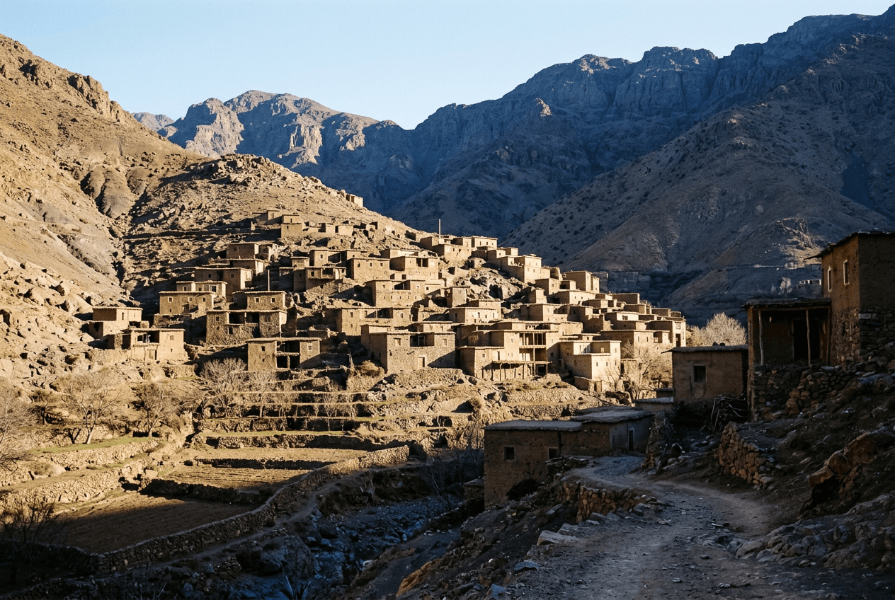
Armed’s mudbrick houses climb the slope, separated by walnut plots irrigated by the Mizane river.
How long does it take to reach Imlil from Marrakech?
It takes 1 h 30 to cover the 65 km between Marrakech and Imlil. The road climbs from 466 to 1,740 m of altitude, through Tahannaout, Asni and Moulay Brahim.
The three valleys loop adds 55 km to the direct route, for a total of 120 km across the day, without a detour into another valley.
The final kilometres, between Asni and Imlil, run tight mountainside bends that limit speed to 40 km/h.
The Marrakech to Imlil distance is 65 km on the P2017 road, via Tahannaout and Asni. Imlil sits at 1,740 m, 1,274 m above Marrakech.
How much does a trip to Imlil cost?
Private transport costs €80 per vehicle in a 9-seater minibus, driver and fuel included. Lunch in Imlil is paid on site, 90 to 140 MAD per person, at the guesthouse serving the walking group.
This price covers the return trip and the driver waiting all day. It does not include lunch or a mountain guide for walkers continuing toward the Toubkal refuge.
The full rate table by vehicle capacity is on the rates page.
| Vehicle | Passengers | Price |
|---|---|---|
| Mercedes Vito | 7 | €70 |
| Hyundai Staria | 9 | €80 |
| Mercedes Sprinter | 12 | €100 |
| Mercedes Sprinter long | 15 | €115 |
The price covers the three valleys loop as well as the direct route, with no mileage surcharge.
When is the best time to visit Imlil?
April to June and September to October give the best walking conditions, between 12 and 22 °C in the valley. The Toubkal summit stays under snow from December to April.
Winter closes the Toubkal refuge trail to walkers without crampons, but Imlil and Armed stay open year-round.
Snow covers the road between Asni and Imlil two to four days a year, in January and February.
| Period | Daytime in Imlil | Night in Imlil | Snow on Toubkal |
|---|---|---|---|
| December – February | 6 – 12 °C | -4 – 2 °C | Yes, from 2,800 m |
| March – May | 12 – 20 °C | 2 – 8 °C | Yes, above 3,500 m |
| June – August | 22 – 28 °C | 10 – 16 °C | No |
| September – November | 15 – 22 °C | 5 – 11 °C | Rarely |
Temperatures recorded in Imlil at 1,740 m. They run 10 to 12 °C below those of Marrakech, at 466 m.
What should you bring for the Imlil trip?
Bring hiking shoes, a warm jacket, water and cash. The temperature drops 10 °C between Marrakech and Imlil, even in summer, and the guesthouse in Imlil does not take cards.
- Hiking shoes with a grip sole
- Warm jacket, even in summer, for the morning air at altitude
- Water, 1 litre per person for the walk to Armed
- Factor 50 sunscreen, altitude increases UV exposure
- Cash in dirhams for lunch and tea in Armed
- Walking poles for the 160 m climb to Armed
Which vehicle suits the Imlil trip?
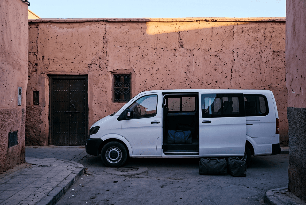
The 9-seater minibus suits most groups on this mountain road. The tight bends between Asni and Imlil make the 15-seater unsuitable above 12 passengers, since it slows to walking pace on the final switchbacks.
What do Imlil and the High Atlas look like?
Which other High Atlas day trips leave from Marrakech?
Oukaïmeden, at 2,600 m, and the Ourika Valley show two other sides of the High Atlas. The Tizi n’Tichka pass, on the road to Ouarzazate, crosses the Atlas on a different slope.
Frequently asked questions
Can you climb Jbel Toubkal on a single-day trip?
No. Climbing Toubkal, 4,167 m, requires two days of walking and a night at the refuge. The single-day trip stops at Armed, 1,900 m, on trails open without a technical guide.
What does the three valleys loop cover?
The loop links Asni, Moulay Brahim and Imlil over 120 km. Each valley carries a distinct village, from the Saturday souk in Asni to the pilgrimage village of Moulay Brahim. The transport price does not change.
Does the Imlil trip suit children?
Yes, from age 6 for the walk to Armed. The 1 h 30 of mountain driving needs more frequent stops than a plain route. Child seats are supplied at no extra charge.
Do you need a mountain guide for Imlil and Armed?
No, not for this trip. The trail between Imlil and Armed is marked and free of technical difficulty. A guide becomes mandatory only for the Toubkal ascent, booked separately in Imlil.
Get a quote
Where are you going?
Send your dates and how many of you are travelling. You get a priced itinerary back — no commitment, no deposit.
- Phone
- +212 714 29 85 18
- Office
- Avenue Mohammed VI, Guéliz — 40000 Marrakech
- Hours
- Every day, 7:00 – 23:00 (GMT+1)